|
| *****SWAAG_ID***** | 330 |
| Date Entered | 13/11/2011 |
| Updated on | 24/03/2012 |
| Recorded by | Tim Laurie |
| Category | Mining Related |
| Record Type | Mining |
| Site Access | Public Access Land |
| Record Date | 02/06/2011 |
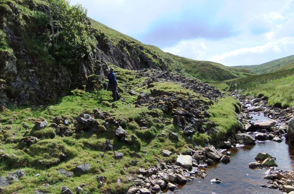
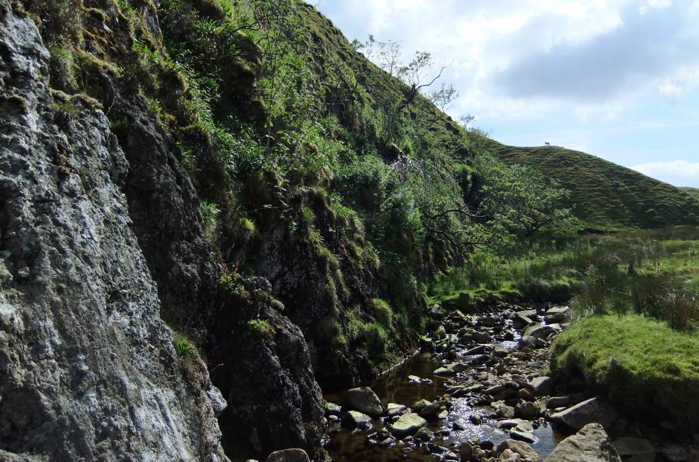
| Location | Great Sleddale. Long Scar. |
| Civil Parish | Muker |
| Brit. National Grid | SD 8265 9888 |
| Altitude | 490m |
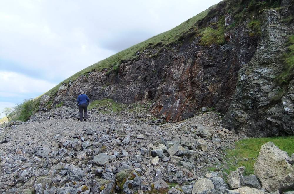
| Geology | Keldside Vein. Subparallel fractures trending N55-70 degrees.Total displacement about 30m. Main Limestone cliff followed by the stream faulted against shale and sandstone (Ten Fathom Grit) |
| Record Name | MUK002 Coppermine shaft at Long Scar, Great Sleddale. |
| Record Description | Details all from Dunham, K.C. and Wilson A.A. 1985. Geology of the North Pennine Orefield, Vol 2 Stainmore to Craven. BGS. HMSO.Chapter 9, as follows:
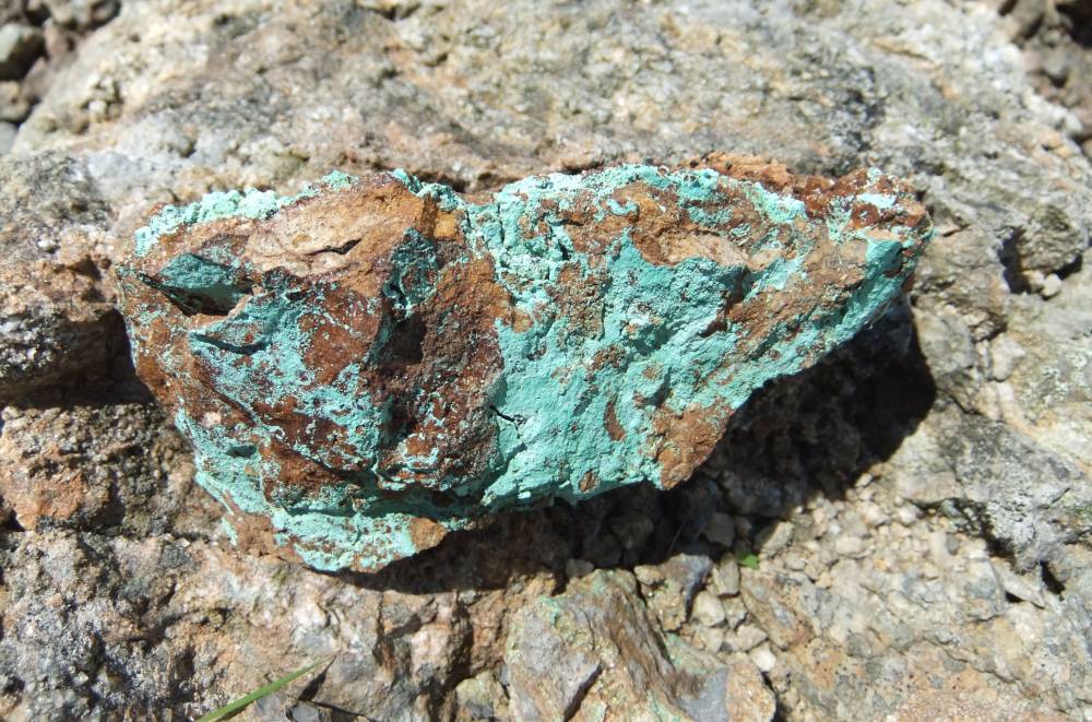
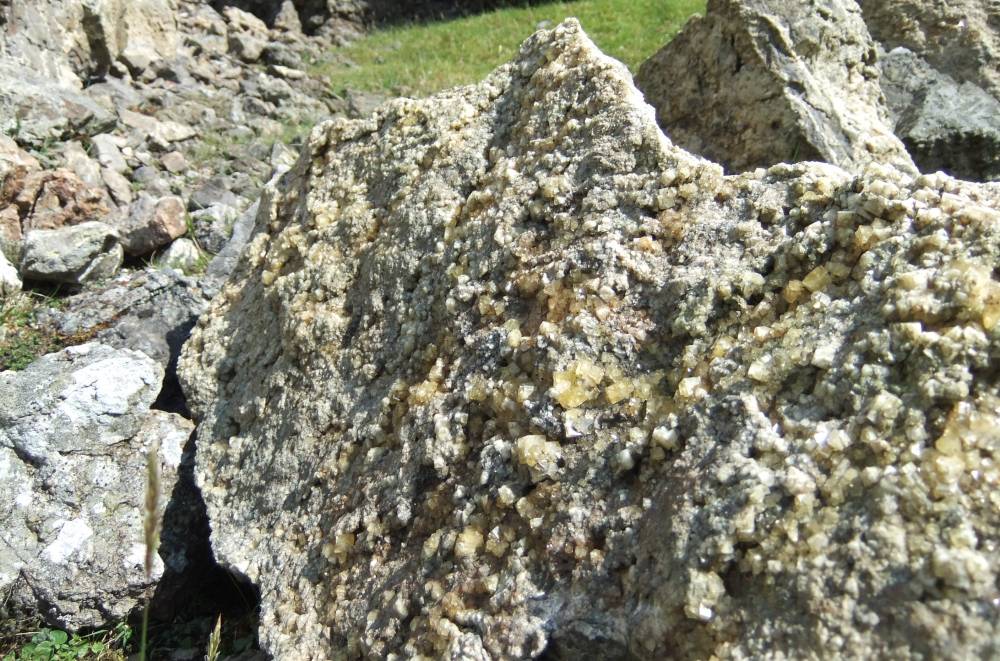
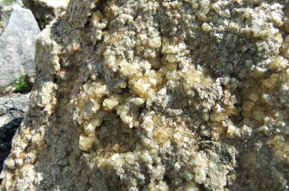
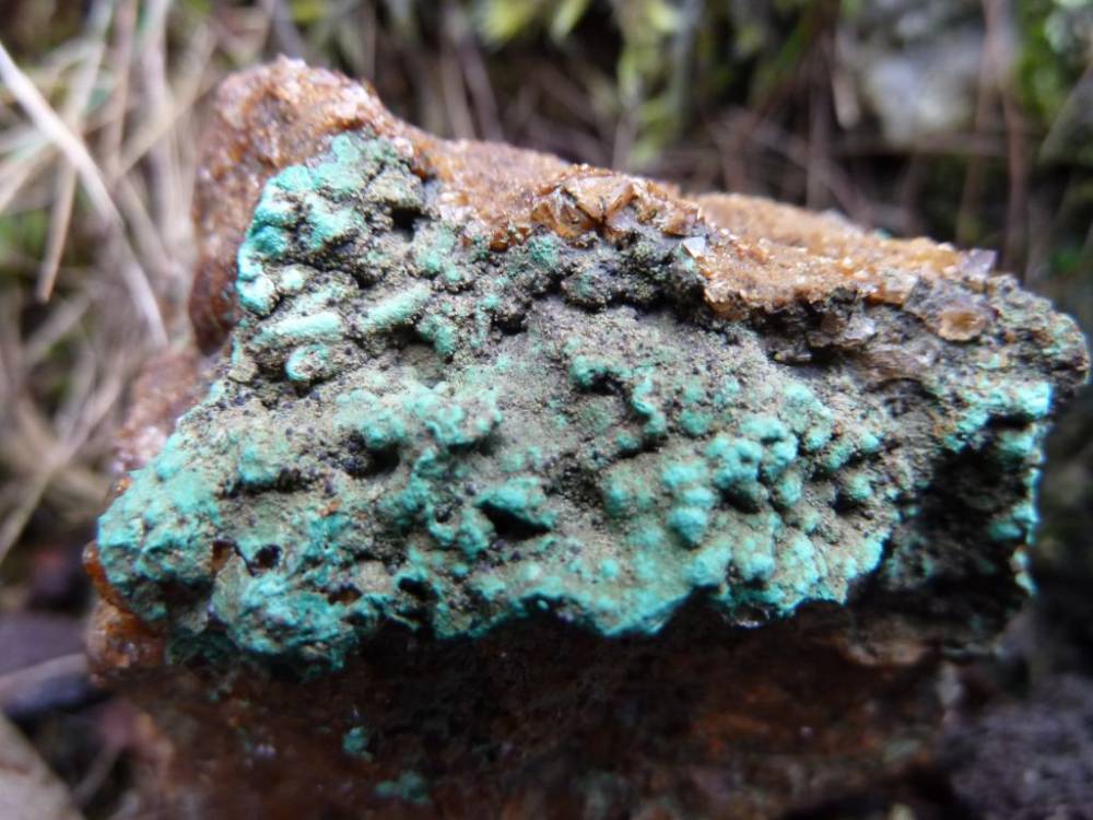
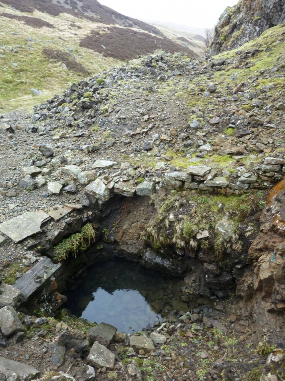
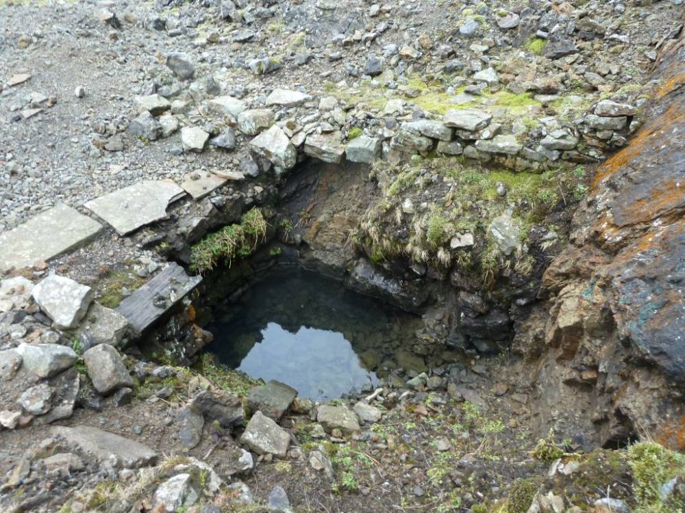
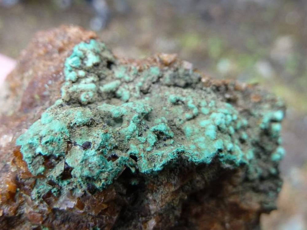
'A shaft on the south-east side of the streamsunk in 1912-14 tested the vein for copper ore. The base of the Main Limestone on the footwall must be about 30ft (10m) below surface but the exact depth of the shaft is not known. The dump contains vuggy veinstuff with pale mauve and amber fluorite, brown oxidised carbonate (?former ankerite, malachite,azurite, and small amounts of chalcopyrite. Type Locality of the inner F Zone of Small, A.T. 1978. 'Zonation of Pb-Zn-Cu-F--Ba mineralisation in part of the North Yorkshire Pennines'. Trans. Inst. of Min. Metall., Vol 87pp. B10-13.
The fault follows the cliff behind the shaft, striking N54 degrees E and dipping 72 degrees NW. Heavy silicification of the limestone accompanies the mineralisation.' |
| Dimensions | See photos |
| Additional Notes | Unusually, the spoil dumps of this mine shaft have not been destroyed by collection. For this reason this record is to be restricted.
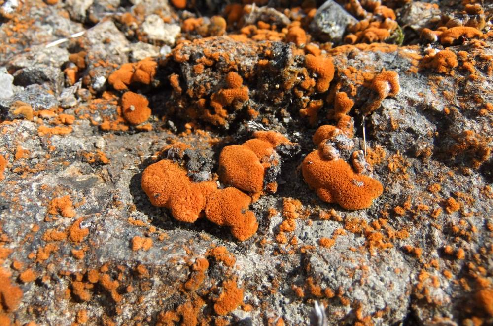
Note the interesting highly coloured and varied metalophyte flora of lichen algae and bacteria on the mineralised cliff. |
| Image 1 ID | 1245 Click image to enlarge |
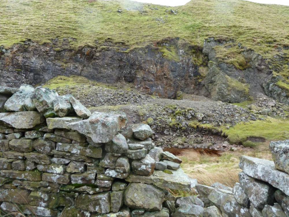
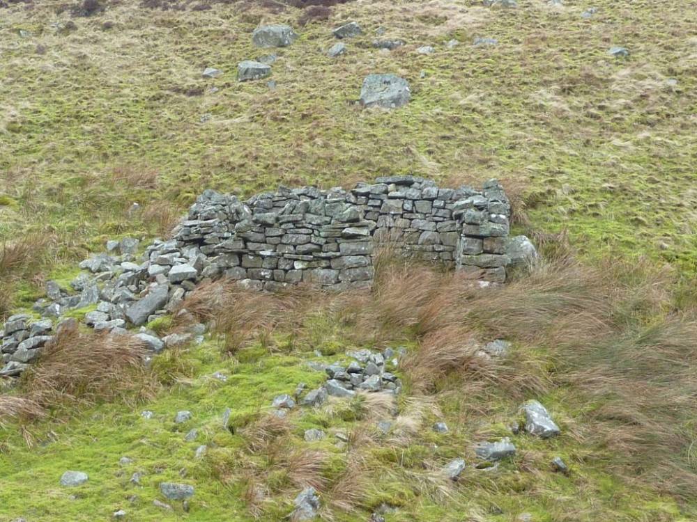
| Image 1 Description | Copper Mine and foot of Main Limestone cliff and dDump |  |
| Image 2 ID | 1246 Click image to enlarge |
| Image 2 Description | Great Sleddale Beck and mine. |  |
| Image 3 ID | 1225 Click image to enlarge |
| Image 3 Description | Bacteria on cliff. | 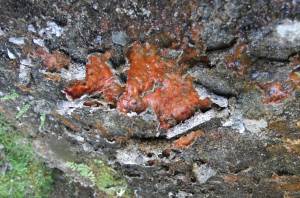 |
| Image 4 ID | 1226 Click image to enlarge |
| Image 4 Description | | 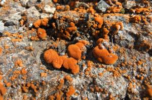 |
| Image 5 ID | 1249 Click image to enlarge |
| Image 5 Description | |  |
| Image 6 ID | 1250 Click image to enlarge |
| Image 6 Description | The cliff and mine dump. | 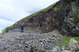 |
| Image 7 ID | 1251 Click image to enlarge |
| Image 7 Description | Amber fluorite. |  |
| Image 8 ID | 1252 Click image to enlarge |
| Image 8 Description | | 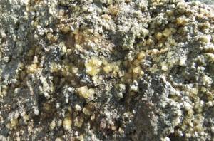 |
| Image 9 ID | 1253 Click image to enlarge |
| Image 9 Description | | 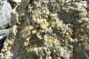 |
| Image 10 ID | 1254 Click image to enlarge |
| Image 10 Description | Great Sleddale beck and vegetated Main Limestone cliff. | 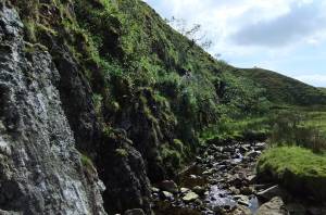 |
| Image 11 ID | 2391 Click image to enlarge |
| Image 11 Description | Copper mining - image: Stephen Eastmead |  |
| Image 12 ID | 2392 Click image to enlarge |
| Image 12 Description | Copper mining - image: Stephen Eastmead | 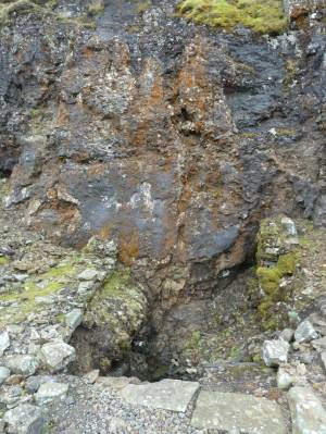 |
| Image 13 ID | 2393 Click image to enlarge |
| Image 13 Description | Copper mining - image: Stephen Eastmead | 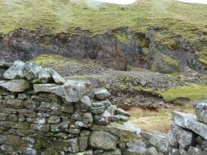 |
| Image 14 ID | 2394 Click image to enlarge |
| Image 14 Description | Copper mining - image: Stephen Eastmead |  |
| Image 15 ID | 2395 Click image to enlarge |
| Image 15 Description | Copper mining - image: Stephen Eastmead | 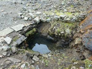 |
| Image 16 ID | 2396 Click image to enlarge |
| Image 16 Description | Copper mining - image: Stephen Eastmead | 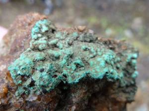 |
| Image 17 ID | 2397 Click image to enlarge |
| Image 17 Description | Copper mining - image: Stephen Eastmead | 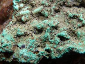 |
| Image 18 ID | 2398 Click image to enlarge |
| Image 18 Description | Copper mining - image: Stephen Eastmead | 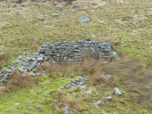 |
| Image 19 ID | 2399 Click image to enlarge |
| Image 19 Description | Copper mining - image: Stephen Eastmead | 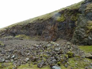 |